
City-Roads Install:
I have installed a copy of GIT and Jpode.JS and NMP. I used NMP to install a clocal copy of City-Roads which I can run using
npm run dev
Then I can run a local copy at: http://localhost:8081/
Now all I need to do is learn the API which is documented here: https://github.com/anvaka/city-roads/blob/main/API.md
https://wiki.openstreetmap.org/wiki/Overpass_API#Quick_Start_(60_seconds):_Interactive_UI
To find out more about the Overpass API query language, see Overpass API Language Guide, as well as the Overpass API Query Language description.
If you are planning to use a pen-plotter or a laser cutter, you can also greatly reduce the print time, by removing very short paths from the final export. To do so, pass minLength option:
scene.saveToSVG('hello', {minLength: 2}); // All paths with length shorter than 2px are removed from the final SVG.
var query = ` [bbox:30.618338,-96.323712,30.591028,-96.330826] [out:json] [timeout:90] ; way(30.626917110746, -96.348809105664, 30.634468750236, -96.339893442898); out geom; `; var result = await fetch( "https://overpass-api.de/api/interpreter", { method: "POST", body: "data=" + encodeURIComponent(query), } ).then((data) => data.json()); console.log(JSON.stringify(result, null, 2));
https://github.com/anvaka/city-roads/issues/20


In the cosole you can reduce the number of lines significantly if you only load Strict Roads
and then remove short lines.
scene.load(Query.RoadStrict, 'ballarat');
scene.saveToSVG('ballarat-road-strict');
![]()
![]()

See: https://rupert.id.au/vpype/
vpype read ballarat-road-strict.svg linemerge linesimplify linesort write BallaratRoadStrict-after-linemerge-linesimplify-linesort.svg
vpype read ballarat-road-strict.svg linemerge linesort write BallaratRoadStrict-after-linemerge-linesort.svg show
The process that I workd out below is rather labor intensive
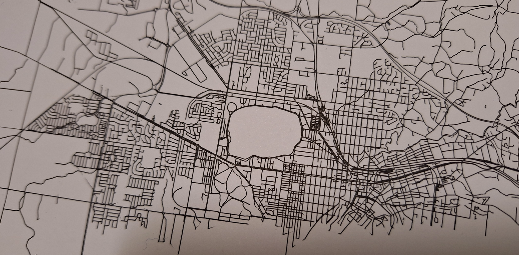
Today as of 1/12/2025 I found a website that makes the process of generateing a SVG map trivial see: https://anvaka.github.io/city-roads/ I found this listed on the following site: https://drawingbots.net/knowledge/tools the only problem is that there is too much detail in these maps for plotting. Main Roads are often reperesennted by 3 lines in parallel. Showing both lanes?
Daniel Datt 30th November, 2025 - Patreon Q&A
https://drawingbots.net/knowledge/tools is AMAZING! The City Roads app does in 30 seconds what it took me ages to do using a clunky multi platform approach using https://rupert.id.au/maperitive/index.php
This is so much eaiser
https://anvaka.github.io/city-roads/?q=ballarat%20victoria%20australia&osm_id&bbox=-37.7223013%2C143.7005645%2C-37.4023013%2C144.0205645# See one of my first Intaglio prints at: https://vimeo.com/1141887356?share=copy&fl=sv&fe=ci Thanks to Dan Catt for showing me how easy it is to create a Intaglio plate using the AxiDraw.
 \
\
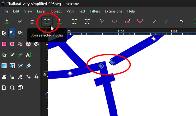
Join selected notes to merge 2 paths into a single path that will plot witout pen lifting (Don't use CTRL+K it joins the paths but keeps the pen lift)
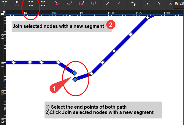
When you have exported a SVG file you can join paths together in Inkscape to reduce pen lifting
Australia Data to download https://download.geofabrik.de/australia-oceania/australia.html
http://maperitive.net/docs/Rulesets.html
https://www.mappa-mercia.org/2013/01/creating-your-own-rendering-rules.html
Get the AxiDraw Software https://www.youtube.com/watch?v=r5mhw8-nrg0
Install AxiDraw plugin in Inkscape
https://braincrunch.tumblr.com/post/9947074703/maperitive-tutorial-generating-osm-map-for-adobe
Well I have worked out the basics.
Workflow:
1) Open https://www.openstreetmap.org
2) Select the area you want to plot https://www.openstreetmap.org/#map=15/-37.5451/143.7799
3) Export and save the .osm file use the Overpass API
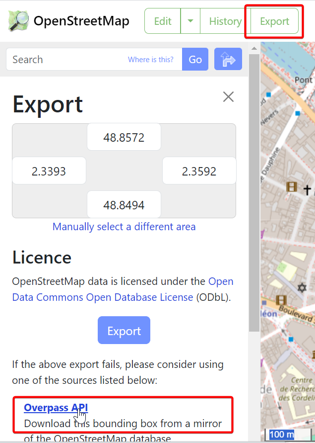
SAVE THE FILE AS A .OSM FILE
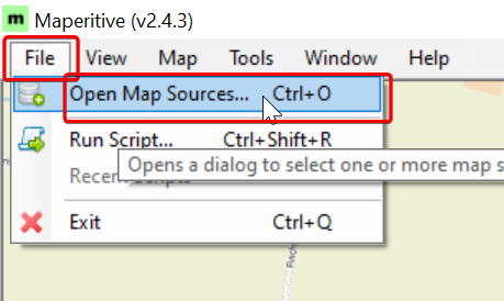
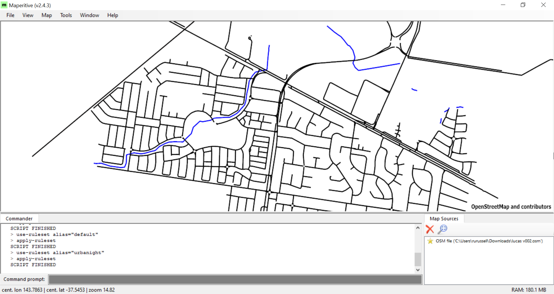
4) Open Maperitive
5) Open the OSM file
6) Remove any unwanted Map Sources
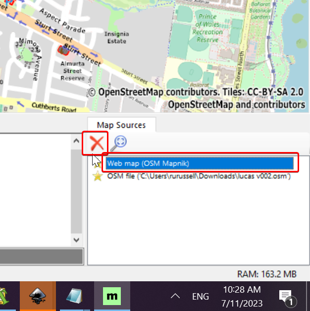
Delete any previous open osm files
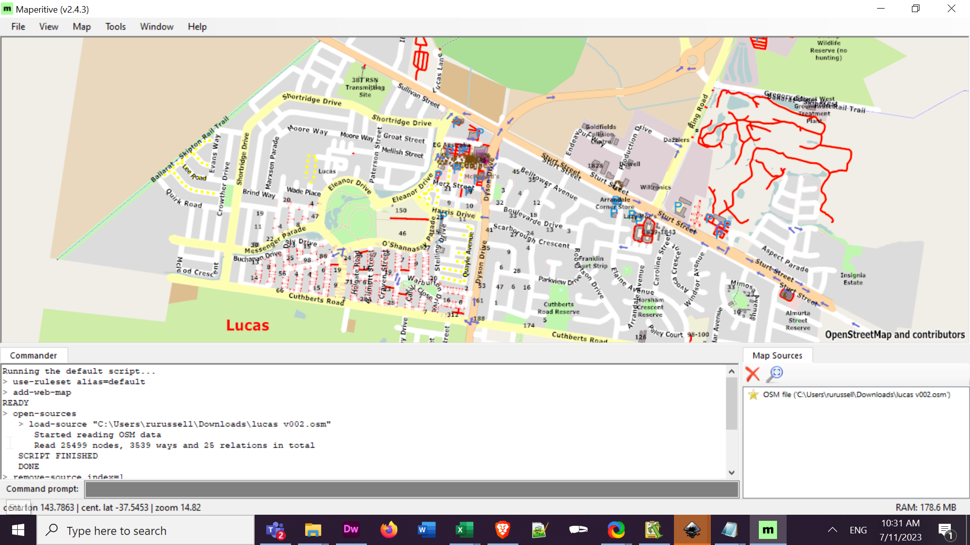
7) Change to Rule set you use for Plotting
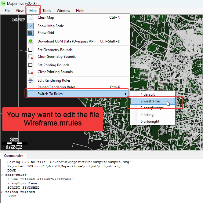
Switch to Urbanight for a wirteframe view of the map data
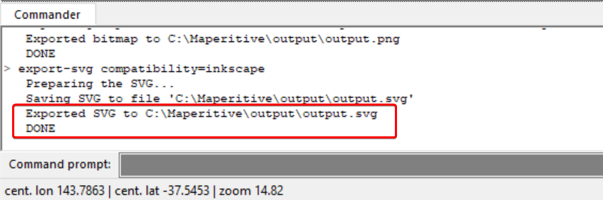
8) Export a SVG (For Inkscape)
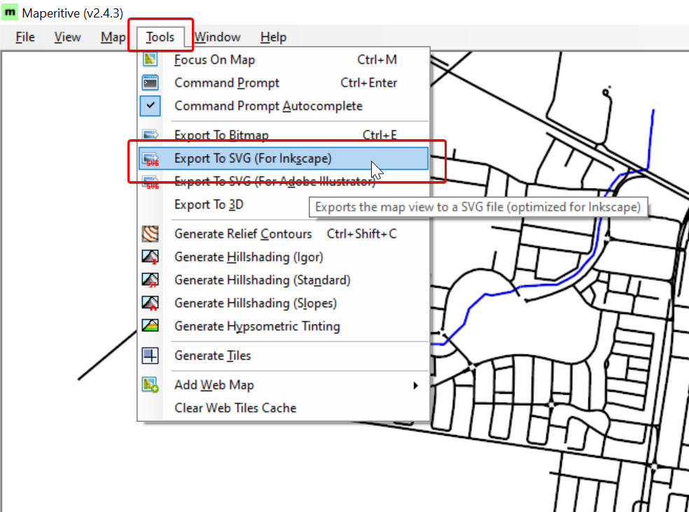
9) Note the location and name of the file
10) Open the Output file in Inkscape
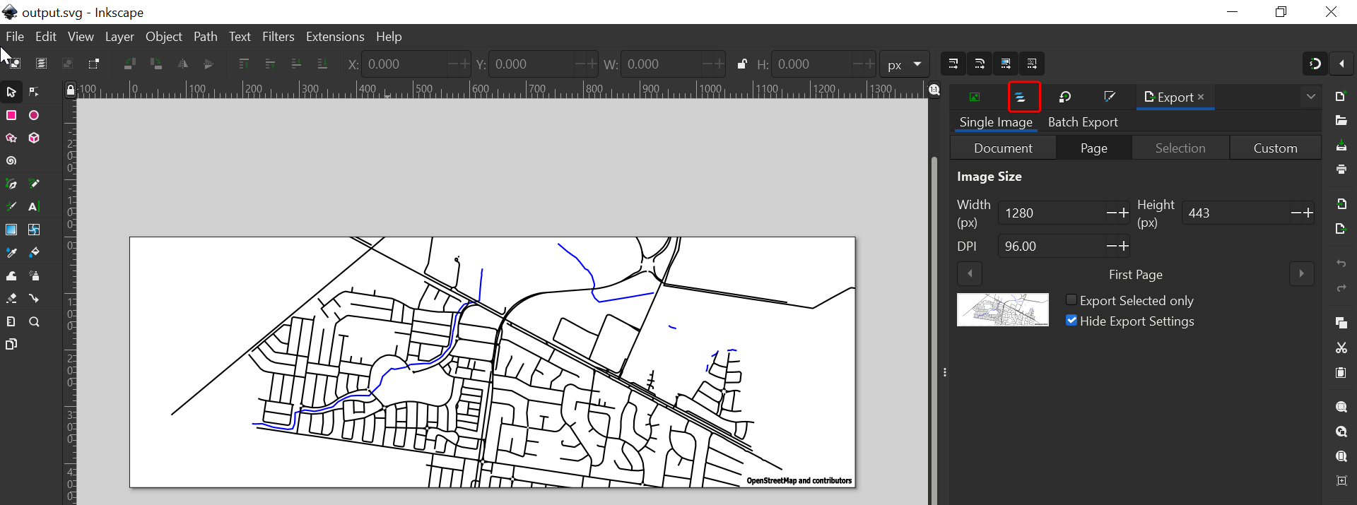
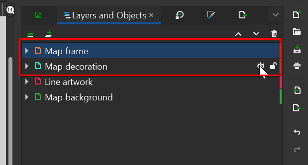
11) Slect Layers
12) hide Map frame and Map decoration
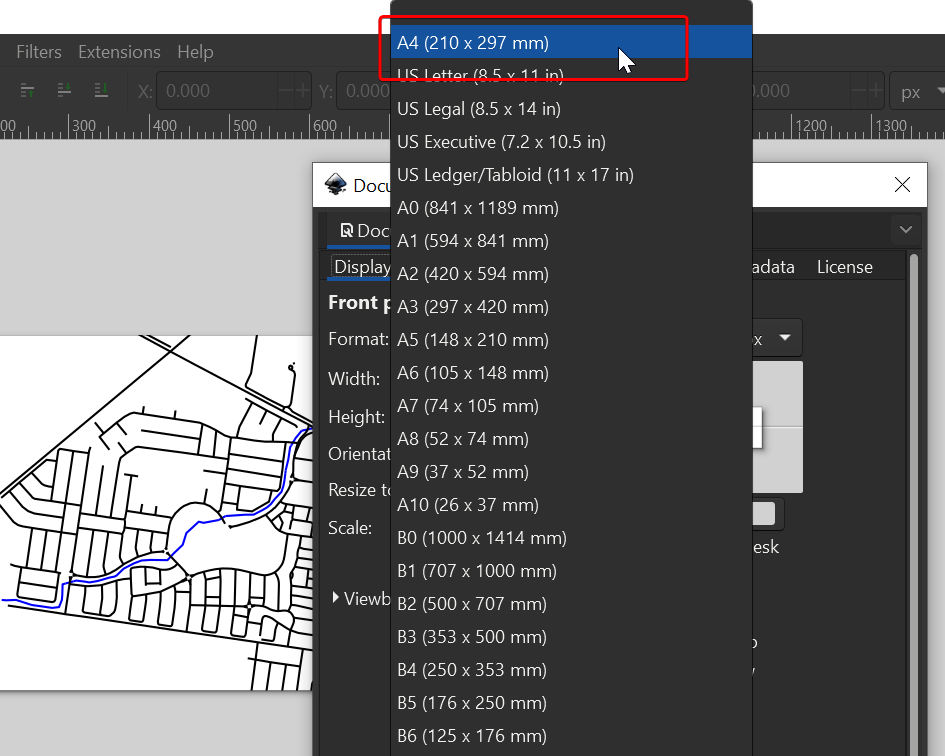
13) Open Document Properties (SHIF+CTRL+D)
14) Click Custon to Change the canvas size to A4
15) Turn off or delete the Map Background
16) Resize or reposition on A4 page
17) Zoom to fit selection on window (3)
18) Plot using the Inkscape AxiDraw Extension :-)
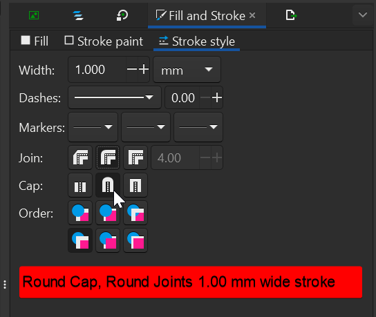
For Red Bubble Set Stroke:
Colour to Black, (Shift Click Black Swatch)
Width to 1.00 mm
Round Caps
Round Joints
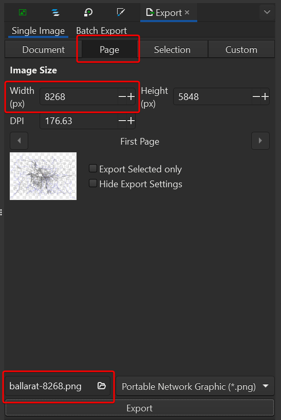
Export PNG file Shift+Ctrl+E
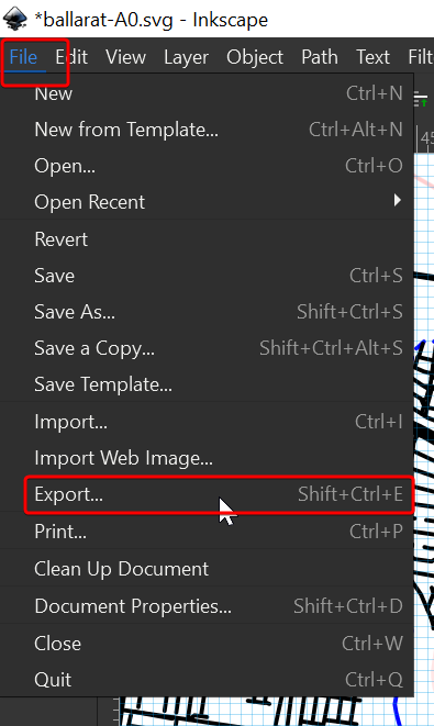
Set Width to 8268
Try using https://jakearchibald.github.io/svgomg/ to clean up SVG files
Ballarat Simplified SVG:
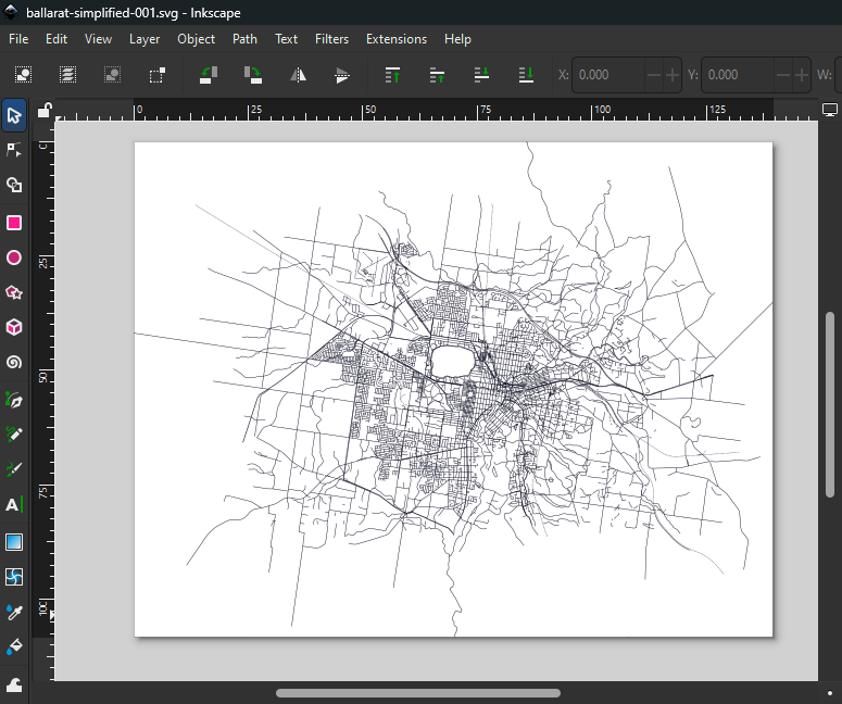
Ballarat Simplified see png above and svg ballarat-simplified-001 SVG below

To remove short lines from an SVG file, you can use the "Purge Short Lines" extension for Inkscape, which is designed to delete lines shorter than a specified threshold. This extension was originally created to clean up heavy PDFs exported from SketchUp but can be used in other scenarios as well. After installing the extension by copying its content into the Inkscape extensions directory, you can access it through the Extensions menu. Note that this extension only supports straight lines, so it may not work on paths containing curves or arcs.
https://github.com/Eneroth3/inkscape-purge-short-lines
You can download the Purge Short Lines extension for Inkscape from its official repository on GitHub or the Inkscape Gallery:
Inkscape Gallery: inkscape.org/~eneroth3/★purge-short-lines
To install:
Download the files from the src/ folder.
Copy them into your Inkscape User Extensions directory (found under Edit > Preferences > System).
Restart Inkscape.
The extension works with straight lines and allows you to delete lines shorter than a specified threshold.

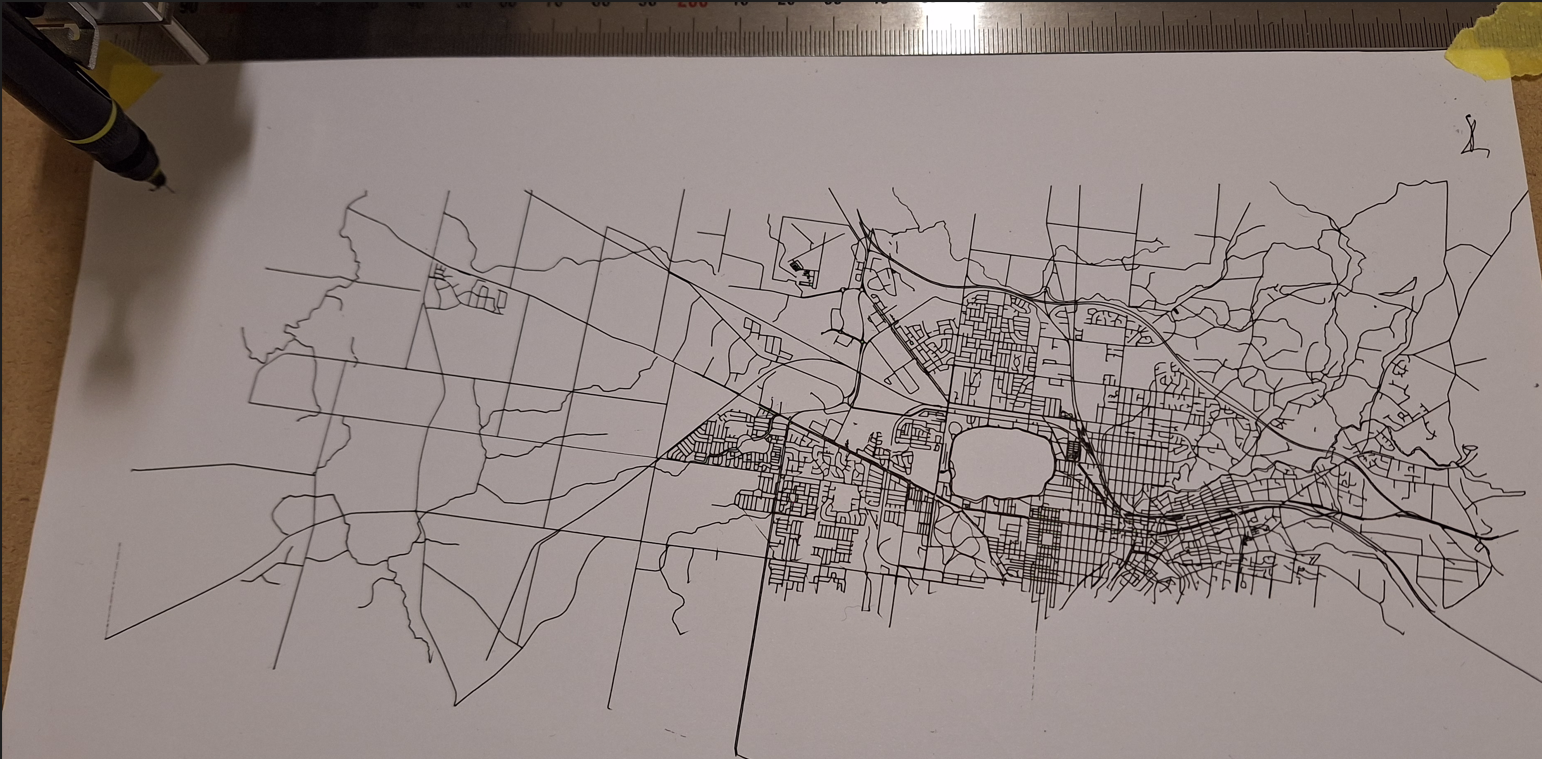
My first plot thanks to: https://heic2png.com/
My first plot thanks to: https://heic2png.com/